|
Audio Version
Getting your Trinity Audio player ready...
|
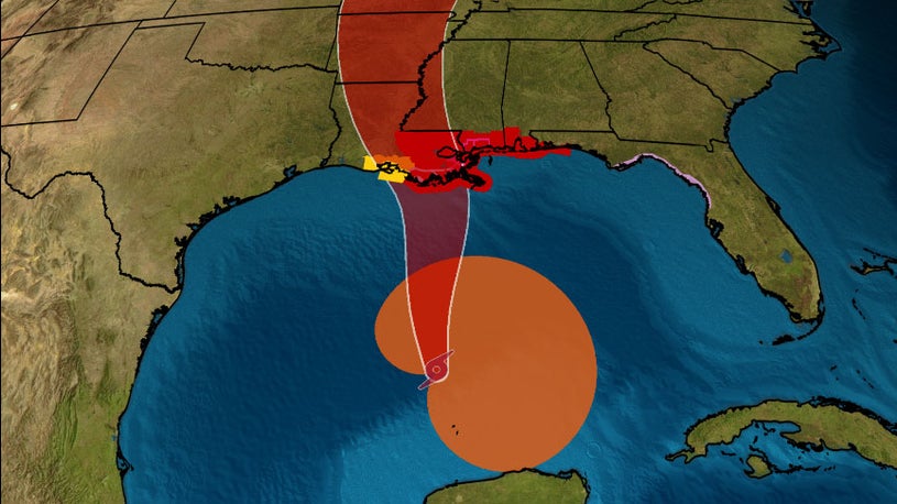
Tropical Storm Cristobal is on the march. After meandering in the southern Gulf of Mexico for several days, the storm is now headed north. The storm is expected to strike the Louisiana coast sometime Sunday.
Cristobal is currently packing winds of 50 mph with a central pressure of 992 MB. The storm is moving north at 12 mph. It is expected to strengthen over the next 24 hours, but not by too much.
The biggest impact of Cristobal will be flooding. Heavy rains and storm surges are a much bigger concern with this storm than the wind, which will likely not be too strong. Fortunately, the storm has picked up speed.
One danger we always have to be aware of with landfalling tropical systems is tornadoes. Twisters can form in the outer bands of tropical systems, adding another level of danger to already potent storms.
Tropical Storm Cristobal is still fairly asymmetrical, so one should not focus on where the center strikes land. Most of the cloud cover is on the eastern side of the storm, so Mississippi, Alabama, and Florida will all be feeling the impacts of the tropical storm.
Even though Cristobal is not expected to be a strong hurricane, you should still keep an eye on it. There are several outlets to help keep you informed, such as local news, the weather channel, weather apps on smartphones, and even weather radios. Weather apps and radios are particularly important in case the power goes out.
Don’t forget to sign up for our newsletter!
