|
Audio Version
Getting your Trinity Audio player ready...
|
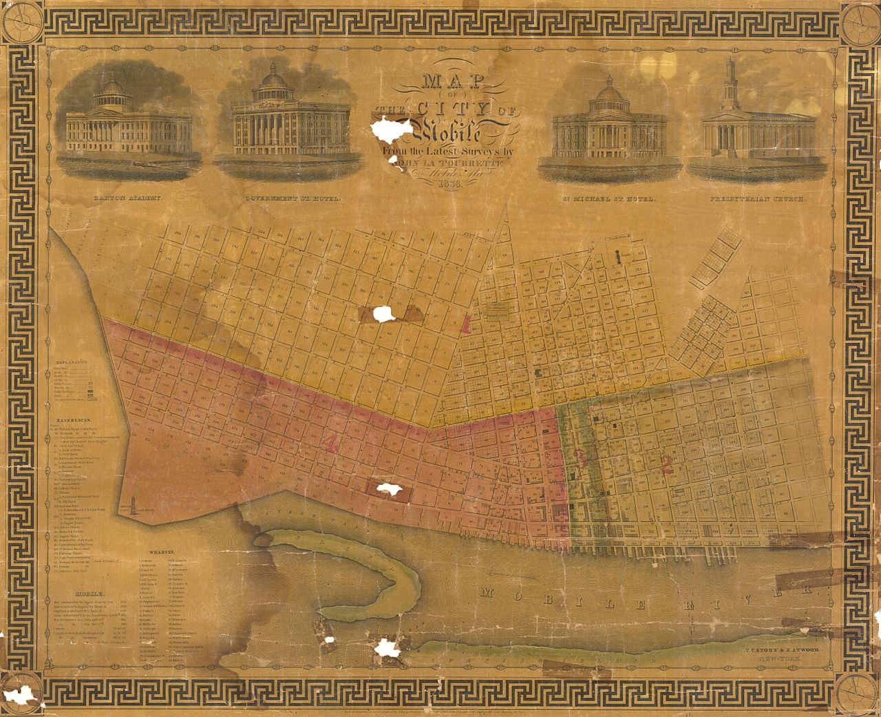
Mobile is a city with a lot of history. From its founding by the French in 1702 to the present day, many flags have flown over the port city. There are many relics of the past to be found related to the city, and I discovered one while browsing Reddit: an old map of Mobile from 1838.

What the Map Shows
If you look closely, you can see the Mobile River at the bottom of the map. The shaded areas are some type of district within the city. The slim blue-green district labeled 3 is apparently Dauphin Street.
When this map was created, Alabama had only been a state for 19 years. Mobile’s economy at the time was dominated by cotton and the slave trade. The city experienced a building boom in the mid-1830s thanks to a strong economy. According to Wikipedia, Mobile was second only to New Orleans in cotton exports at this time.
The strong economy wouldn’t last, as the Panic of 1837 would see the beginning of an economic depression that would last until the next decade.
More History of Mobile
There are many local attractions for those interested in Mobile’s history. Did you know Mobile has its own museum of history? The Mobile Museum of History is located at 111 South Royal Street in downtown Mobile. This Sunday the museum is offering FREE admission between 1 and 5 PM.
The museum also operates Colonial Fort Conde. Admission to the museum includes admission to the fort.
There is also the USS Alabama located on the causeway. This museum ship served in the Atlantic and Pacific in World War 2. History buffs will have a field day with this amazing attraction.